
welcome to FINCH DRONE SOLUTIONS
At Finch Drone Solutions, we’re not just flying drones—we’re reshaping the industry. Covering South West and Cornwall, using our cutting-edge drones we are here to revolutionize the way businesses operate across agriculture, construction, infrastructure, emergency response, and beyond. With precision, efficiency, and sustainability at the core of what we do, we’re bringing world-class aerial solutions to the region, unlocking new possibilities and helping organizations see their work from a whole new perspective. Join us as we lead the South West into a bold, innovative future.
With one flight at a time.

Why Drones Are Better Than Traditional Methods
Drones offer a faster, safer, and more cost-effective solution than traditional inspection, surveying, and data collection methods. With the ability to reach hard-to-access areas without needing scaffolding, ladders, or heavy machinery, drones significantly reduce risk and downtime. They provide high-resolution imagery, real-time data, and thermal or 3D mapping capabilities that enable more accurate decision-making on the spot. Whether it’s for construction, infrastructure, agriculture, or emergency response, drones streamline operations, save resources, and deliver better results every time.
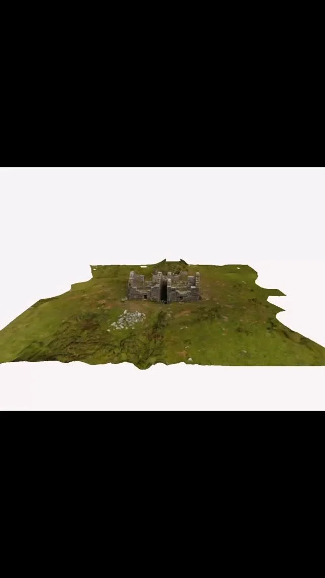
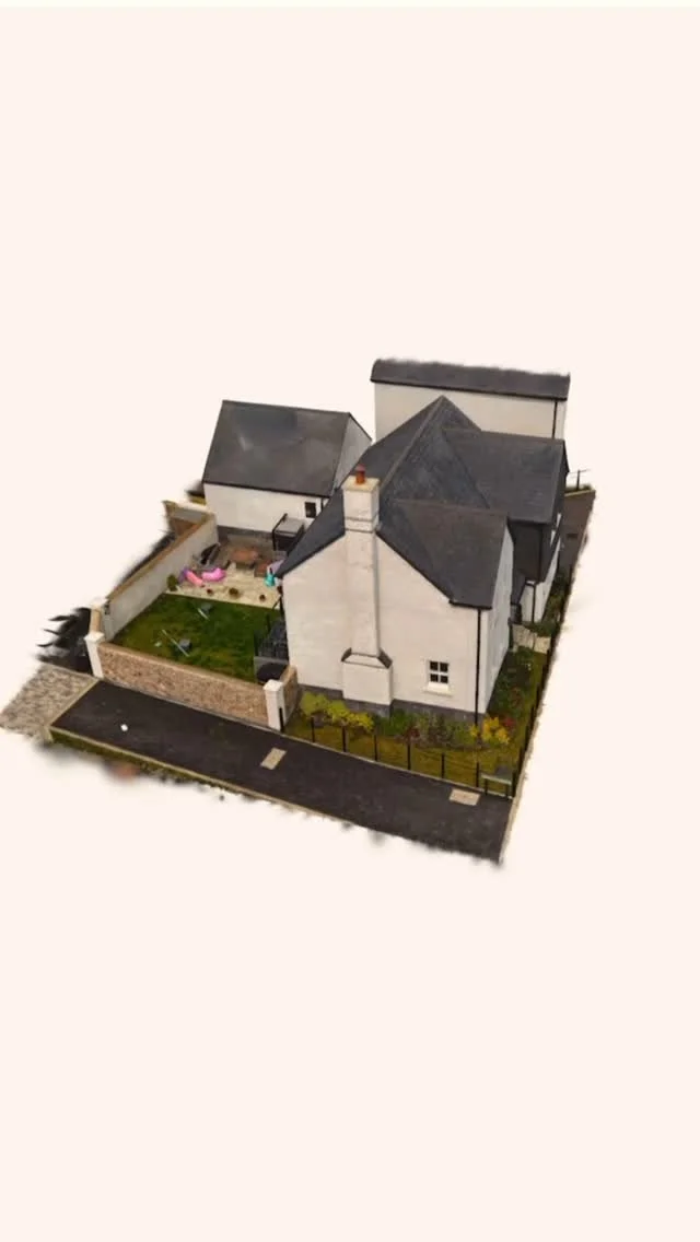
gaussian splatting
The new Next-Level Aerial Visualization & 3D Mapping Tool. Welcome to the cutting edge of aerial imaging and 3D reconstruction. Drone Gaussian Splatting is a revolutionary technology that transforms drone-captured video into stunning, photorealistic 3D scenes—fast, accurate, and immersive like never before.
-
Gaussian Splatting is a new technique in computer vision that reconstructs complex 3D environments by placing millions of tiny, semi-transparent “splats” (Gaussian ellipsoids) in space. When captured by a drone, your landscape, building, or site becomes a vivid 3D model that looks and feels like the real world. Unlike traditional photogrammetry or LiDAR, Gaussian Splatting offers:
Incredible Detail & Realism – Perfect for architectural previews, construction sites, or showcasing real estate.
Fast Processing – No need to wait days for rendering. Models are generated with remarkable speed.
Dynamic Viewing – Fly through, rotate, zoom, or embed into interactive platforms for clients or stakeholders.
-
Whether you’re in real estate, construction, film production, or landscape planning, Drone Gaussian Splatting can change the game:
Stunning Presentations: Show your clients 3D walkthroughs with cinematic quality.
Accurate Site Analysis: Get precise spatial data and real-time environmental understanding with 1cm accuracy.
Marketing Edge: Stand out with a visual format that grabs attention and drives engagement.
-
We specialize in combining aerial drone expertise with state-of-the-art Gaussian Splatting technology to deliver results that are visually stunning and technically powerful
Tailored 3D captures for your unique project
Scalable solutions—from small properties to large terrains
Easy integration into websites, presentations, and VR environments
Reliable, professional service with a creative edge
-
Let’s create something incredible together and innovate. Be one of the few organisatins who use this new technolagy.
Contact us today to discuss your vision and see how Drone Gaussian Splatting can bring it to life in full 3D
OUR services
-
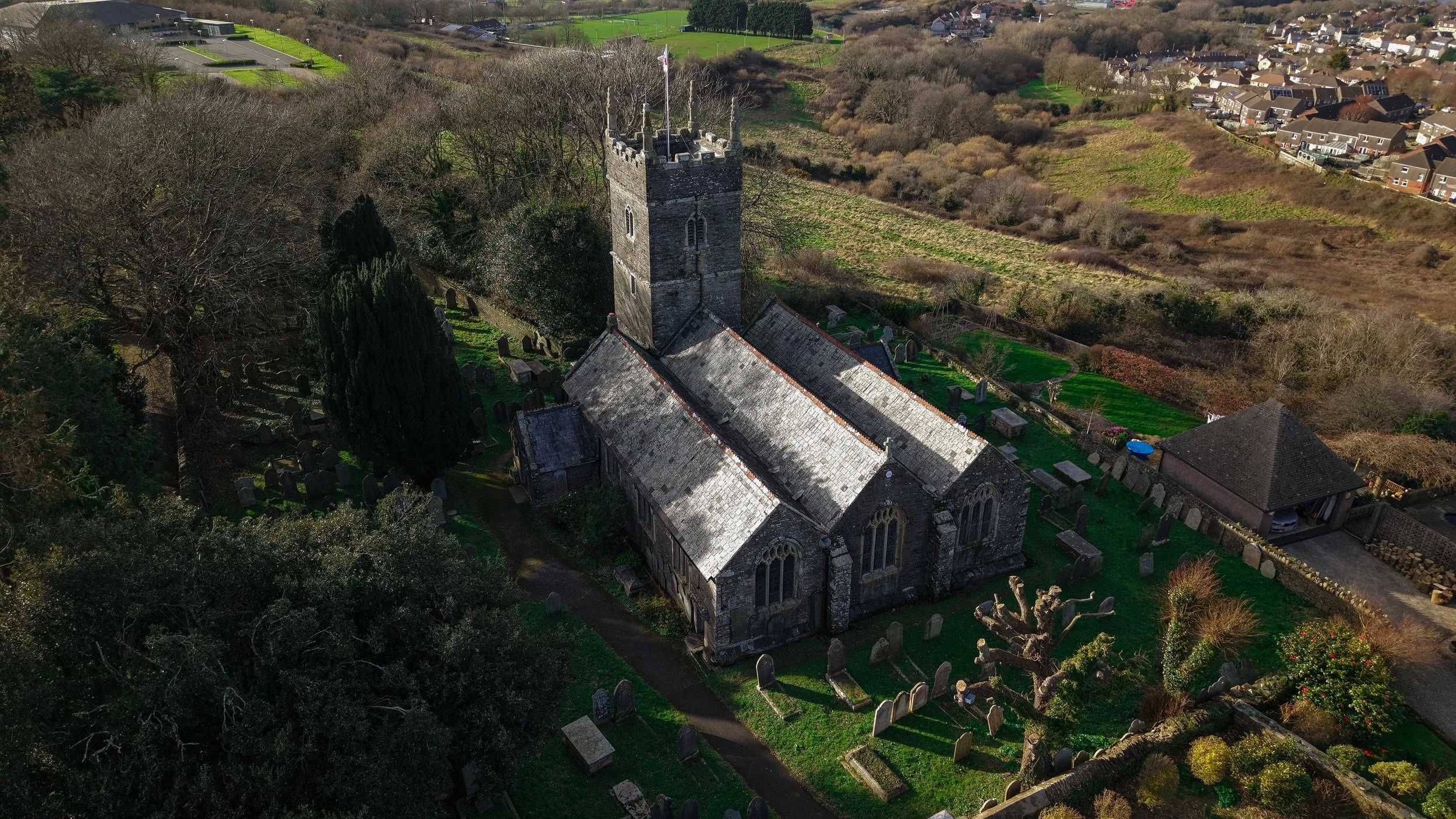
![Aerial view of a historic stone church surrounded by a cemetery. The church features a tall tower and large, arched windows. Tombstones are scattered throughout the grassy area around the church. The landscape includes trees, residential buildings, and open fields in the background.]()
Aerial photography
We can shoot single photos, AEB photos, burst photos and timed shots in 4:3 or 16:9 aspect ratio. We can photograph in two formats depending on your needs, JPEG / RAW as well as in 12MP or 50MP. Additionally, edit the photos with colourgrading if needed.
-
![Aerial view of a residential area with rows of houses and green fields under an overcast sky.]()
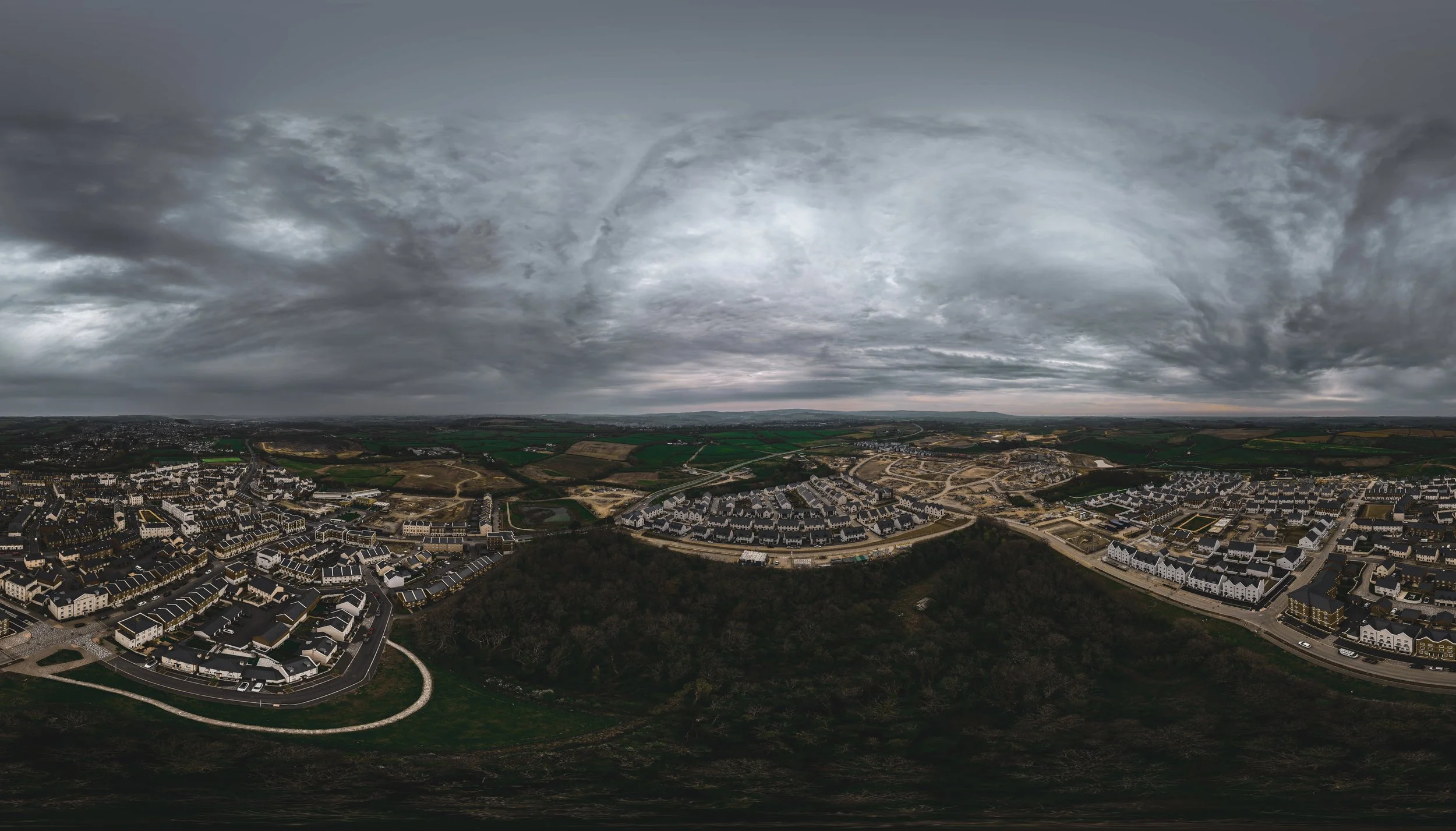
Aerial Panorama
We can create a beautiful panorama by overlaying multiple photos and stitching them together. We can shoot in wide mode, free mode and vertical mode.
-
![Aerial view of a residential suburban area with houses and roads under a cloudy sky.]()
Panorama 360
We can create a beautiful panorama 360 photo by uploading it to Momento 360, by overlaying multiple photos and stitching them together.
-
![Aerial view of a residential neighborhood with uniform houses.]()
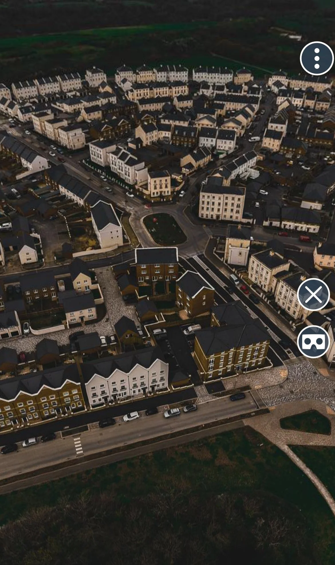
360 viewing
By creating a 360 sphere photo we can upload the photograph to software allowing you to view an expansive area. there will be a link at the bottom of this website.

OUR SERVICES
Aerial Videography
We can record up to 4K 24FPS—60FPS and at 4K 120FPS for slow-motion purposes as well as Hyperlapses. We can also record in 2.7K for vertical shooting, which is perfect for TikTok and Instagram reels. Depending on your needs, we can record in either HGL or DLOGM.
Aerial videography EDIT
We can record a collection of footage, after this we will edit it into a smaller video perfect for marketing and social media.
ROOF / TOWER INSPECTION video
We offer an hour’s worth of work for a set price. For anything over an hour, we charge an extra per 15 minutes, the reason we charge extra is if the building is larger for example a row/block of flats or commercial properties. We can record and inspect the hard-to-reach places and we will send you the video meaning you can send the footage to whoever you wish.
DAY SERVICES
We can offer day services for weddings or events to record moments throughout the day and capture the special moments.
Customer Testimonials
“I can highly recommend Finch drone solutions - harry shows fantastic attention to detail, really listens to his customer's needs and he’s a very switched-on, highly capable drone operator and videographer. Throughout our time of working with Finch, harry was highly personable and very professional - highly recommend!”
— Sam Waites - Activities Manager - Mount Batten Centre.

Our drone insurance provider from FPV UK membership includes £5m public liability insurance for all of your lawful flying. Including up to £15k of commercial flying. It complies with EC 785/2004 which is a legal mandatory to fly drones With this insurance it give us greater freedom meaning we can Fly “to a minimum distance of 30m from uninvolved people (15m on take-off and landing) – this forms an imaginary bubble around the person (unlike the open category which requires a 50m horizontal distance) – i.e. overflight is allowed for association members” This 30m rule is only for recreational uses and not for commercial use Article 16 privileges are only for training & sport flying - you would not be able to use these for commercial operations
We have completed a number of courses from COPTRZ ACADEMY making our drone pilots more skilled and knowable. We also received our A2 COFC from attending their virtual training and taught by the brilliant training team at COPTRZ

Here at FDS, we hold the needed licence to fly drones in the UK. We have the licences for the Open sub-categories A1/A3 and the A2 open category. These were given to us by the UK CAA meaning we are allowed to fly drones weighing up to 25kg. The A1 category allows us to fly drones that weigh up to 250g over uninvolved members of the public. The A2 allows our organisation to fly drones weighing up to 2kg with a 50m horizontal/lateral distance away from uninvolved people (people not part of your flight). You can give people a face-to-face safety briefing & gain their consent to then consider them 'involved' or 'under your control', allowing you to fly closer to a safe distance. Also, this means we can fly in residential, recreational, commercial, and industrial areas Also, the A3 drone category states that we must maintain a minimum horizontal distance of 50m from uninvolved people and 150m from congested areas if we are flying anything above 2 kg.

Follow us on social
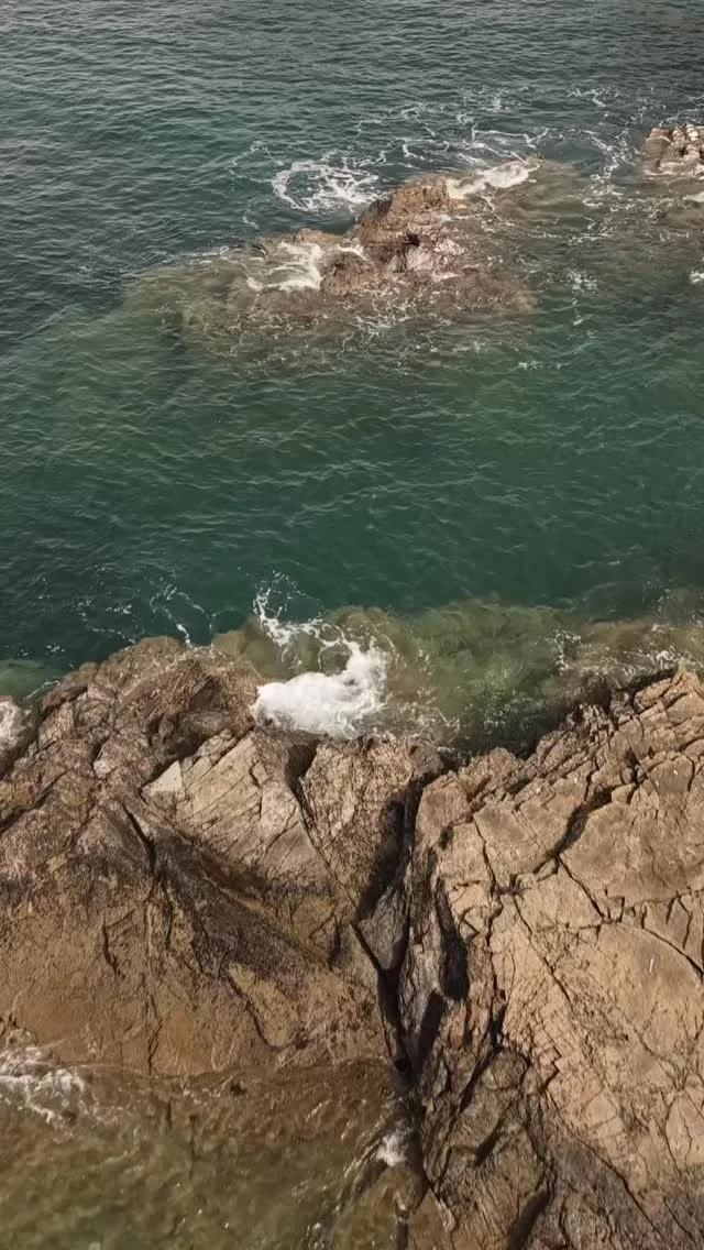
![🌊 Wild Coast Energy | Noss Mayo Series [3/3]
The final image in our Stoke Beach panorama series.
Crashing waves, jagged rock, and raw Devon power — captured from above.
This one’s all about motion and detail. The sea doesn’t pose](https://images.squarespace-cdn.com/content/v1/67f933e2e56bc43ecf4273da/1749924365834-K1RTHIURS4J3FMAA7WP8/image-asset.jpeg)
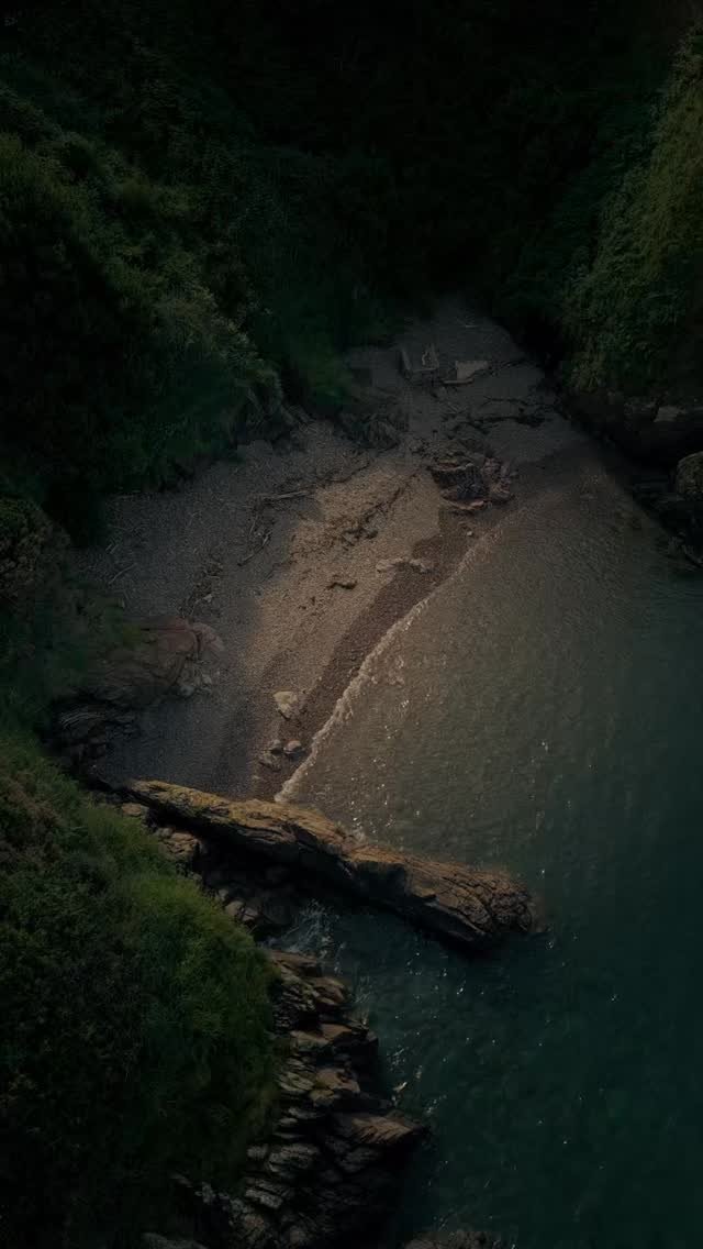
![🌊 Coastal Cutaways | Noss Mayo Series [2/3]
This aerial slice of the coastline captures the layers of time carved into the rock — nature’s architecture on full display. Shot just off Stoke Beach, this one feels like a painting in motion](https://images.squarespace-cdn.com/content/v1/67f933e2e56bc43ecf4273da/1749919171849-KZCCW6WCY8W0T567AKD0/image-asset.jpeg)
![🌊 Stoke Beach from Above | Noss Mayo Series [1/3]
One of three panoramas we captured today along the rugged South Devon coastline. The sharp ridges and deep blue waters at Stoke Beach look unreal from the air — almost like another planet.
🖼](https://images.squarespace-cdn.com/content/v1/67f933e2e56bc43ecf4273da/1749919171849-OLJYRE9HKHBYUE7OFV3B/image-asset.jpeg)
Contact Us TODAY FOR A FREE QUOTE
Interested in working together? Fill out some info and we will be in touch shortly. We can’t wait to hear from you!